
Crisis Map : Tracking Violence in Bangladesh
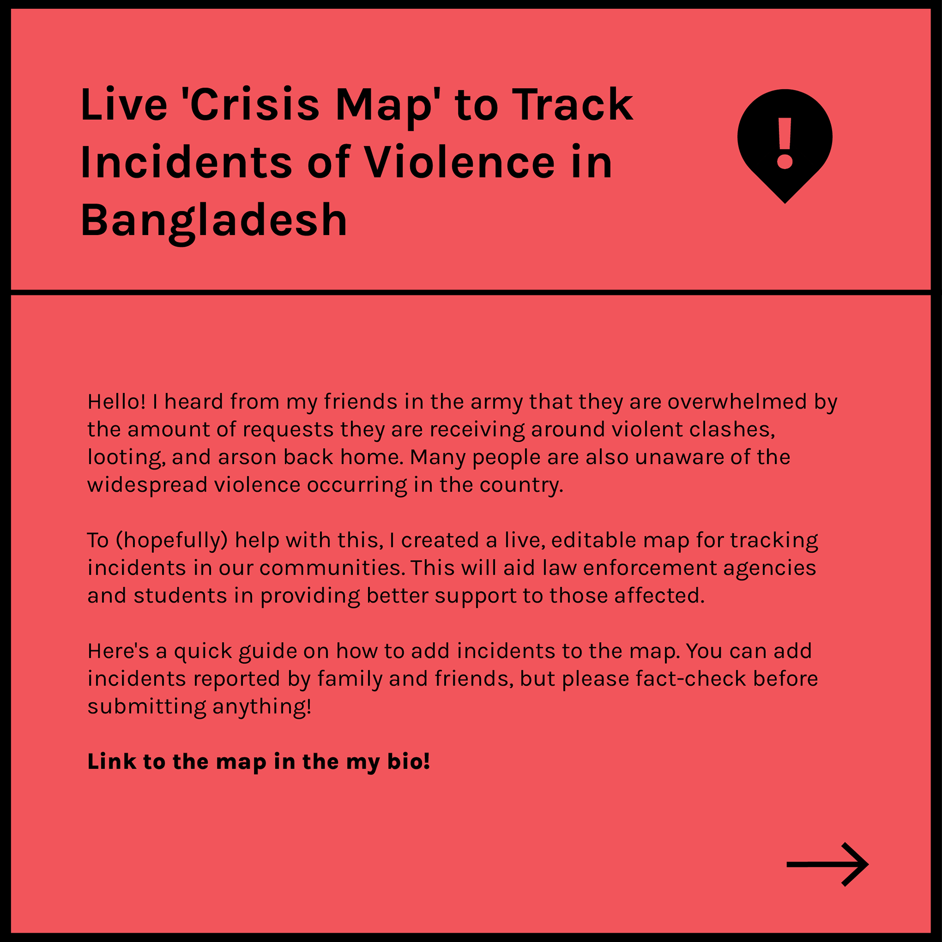
Following the student-led revolution in Bangladesh in August 2024, I developed a live, crowd-sourced Crisis Map using Google Maps' built-in location tagging and categorisation features. The goal was to enable citizens to document and track incidents of violence — including clashes, arson, and looting — to raise awareness and aid response efforts.
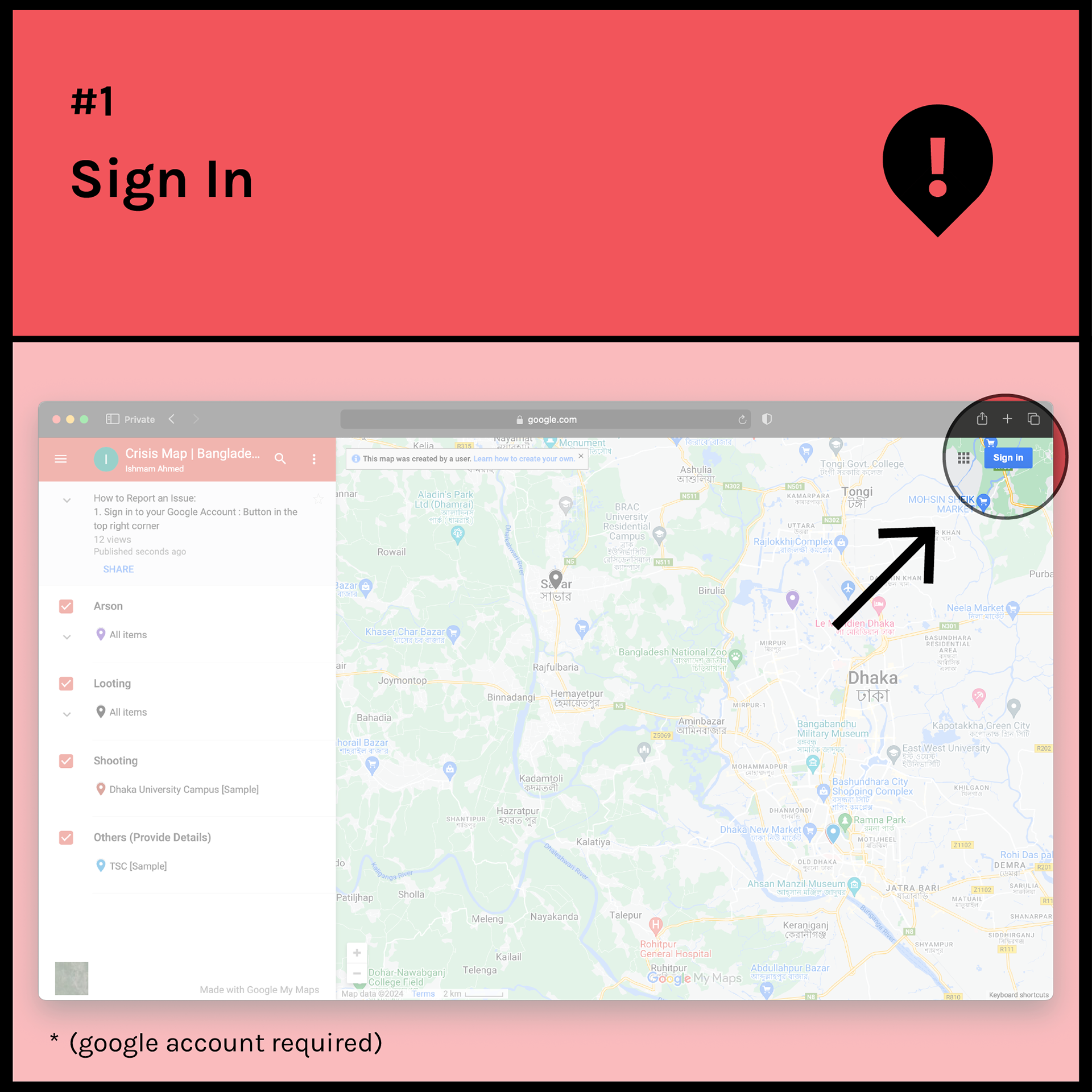
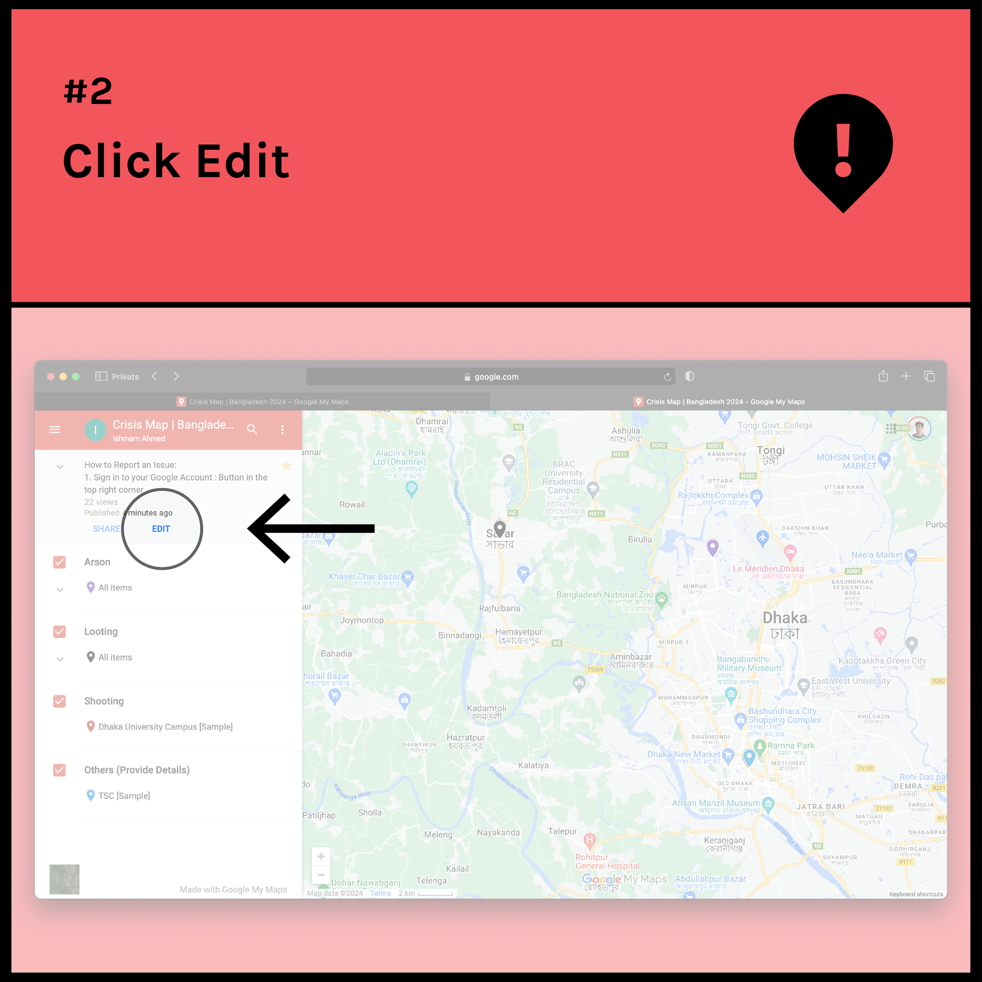
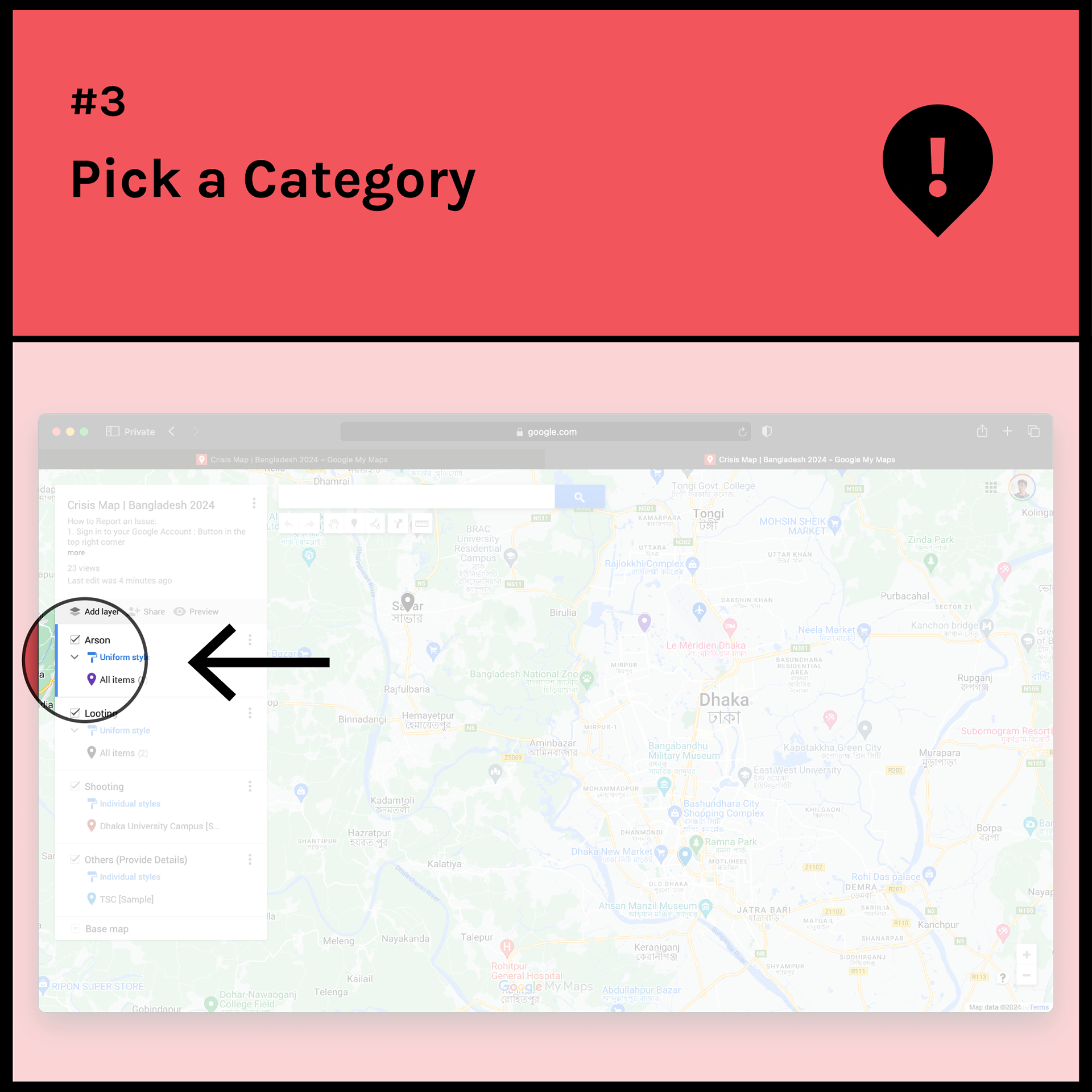
The map allows users to:
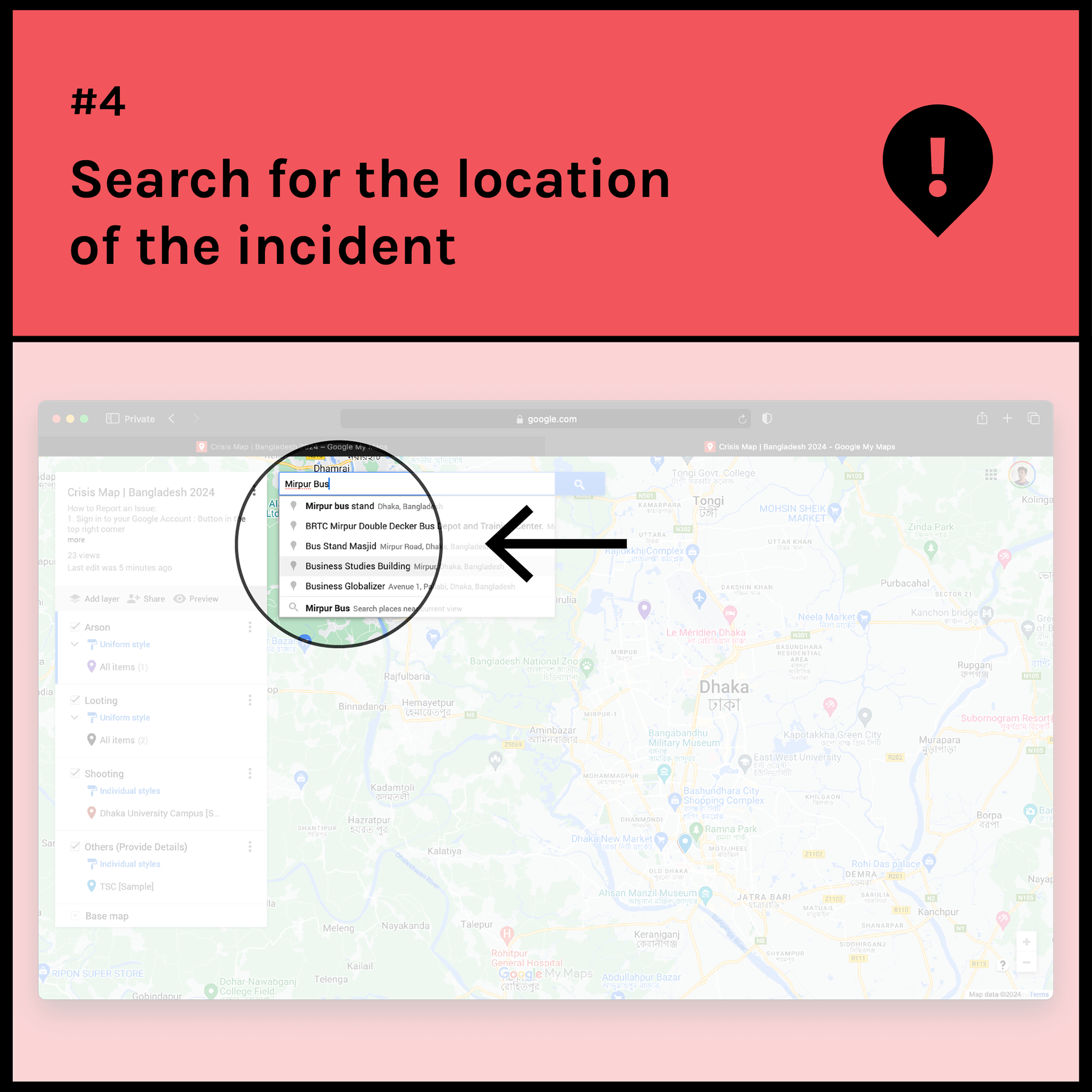
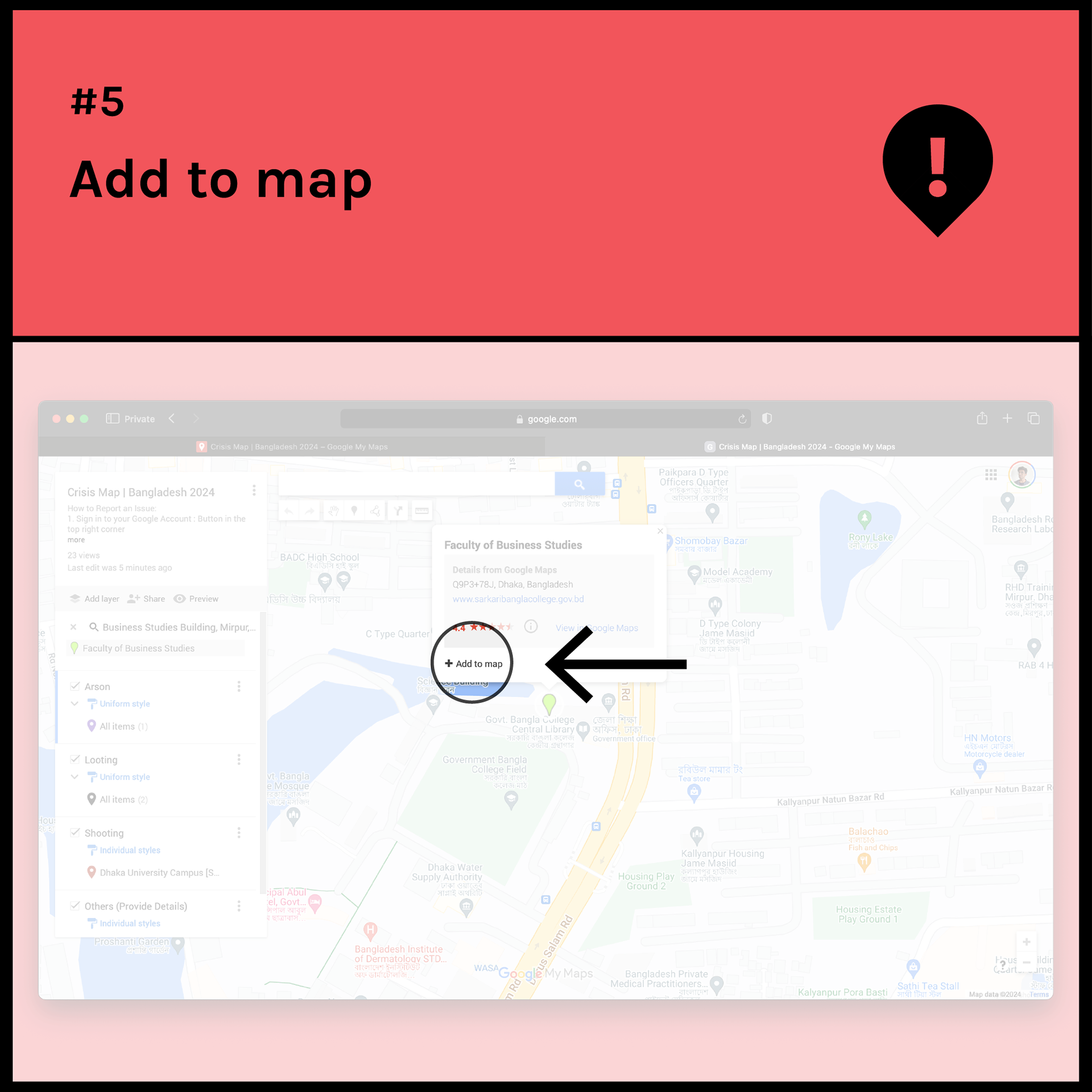
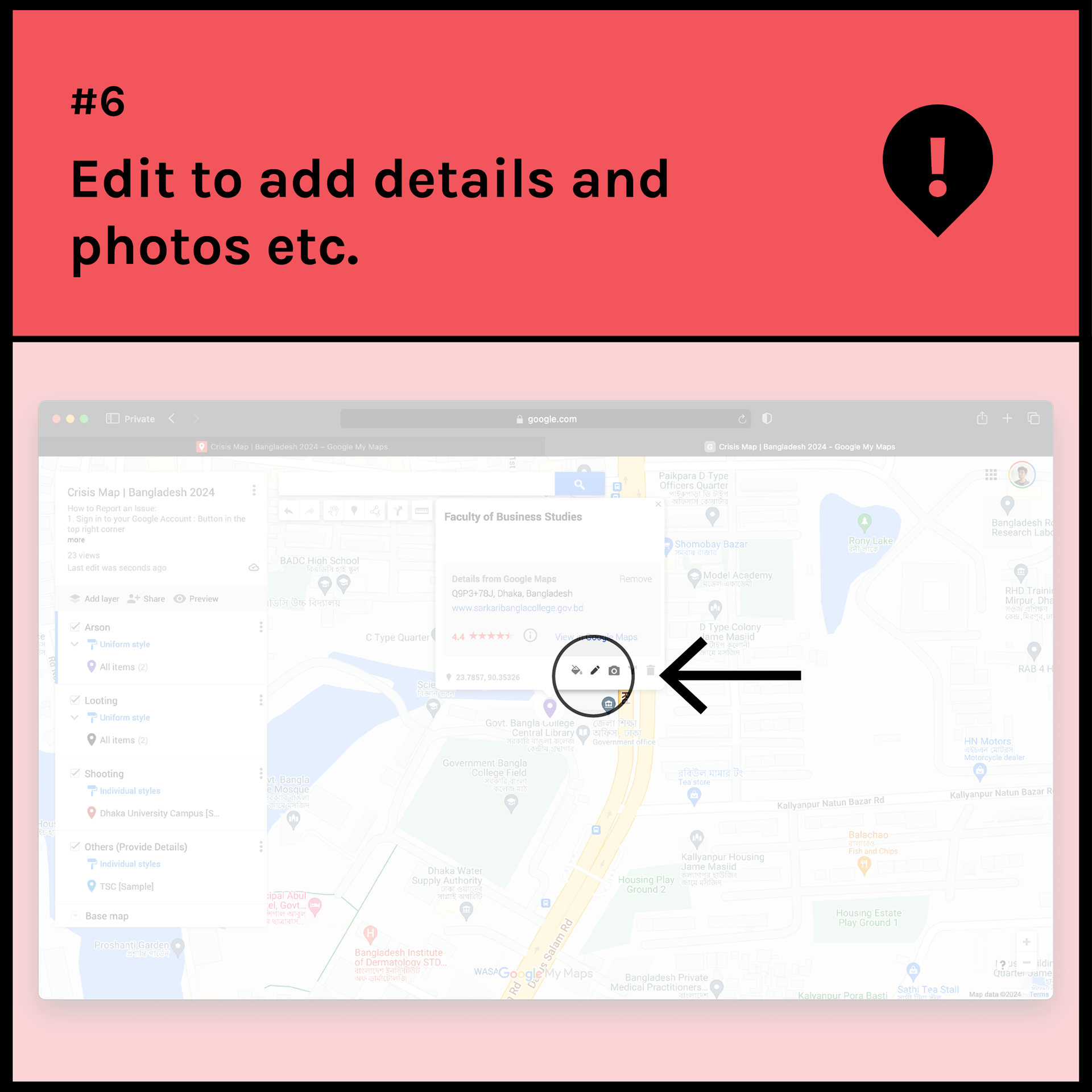
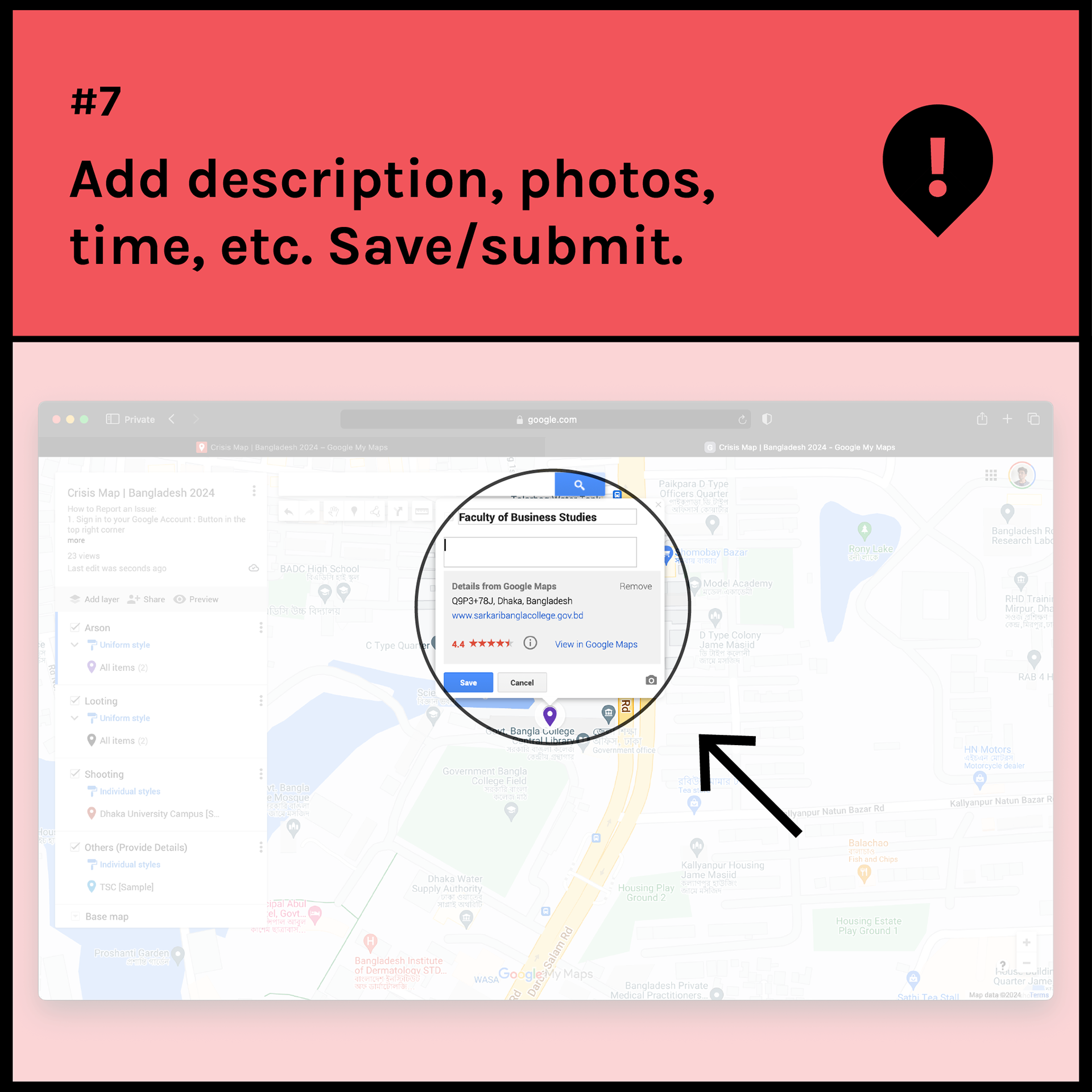
- Report incidents by selecting predefined categories
- Pinpoint locations and add descriptions or media evidence
- Provide verified, real-time data for law enforcement, researchers, and activists
- Report incidents by selecting predefined categories
- Pinpoint locations and add descriptions or media evidence
- Provide verified, real-time data for law enforcement, researchers, and activists
The initiative aimed to bridge information gaps in crisis response and empower local communities with a visual, participatory tool for safety and situational awareness.
(I unfortunately couldn't publicise it enough on relevant social media channels - so the tool remained largely unused besides a few entries by my close friends on Facebook.)